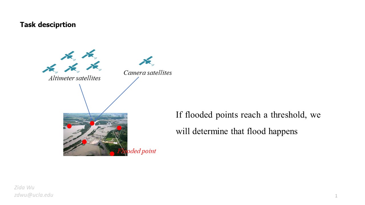
Summary:\ In this project, there is a netowrk of SWOT satellites with 5 altimeters satellites and 1 camera satellite running on different orbits. Each of them has different sensor to detect the ground points of the river. The goal is to decide whether the flood happens or not.
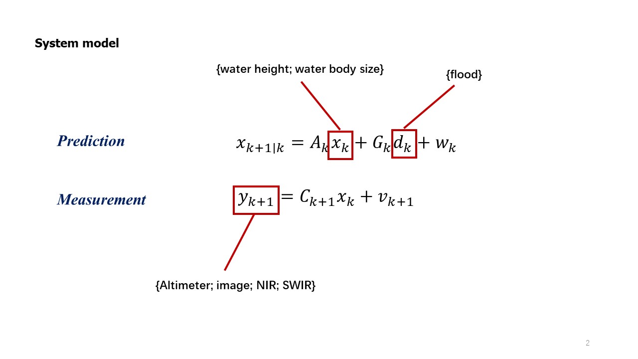
For our part, we will give the estimation as well as the confidence given dentralized sensor information from satellites.
P1: big picture of current stage\ P2: how to fit current problem into our previous work. (in single agent view)\ P3: problems need to be solved for decentralized satellites. \ P4: backup notes.\